Pre-project surveys
USFWS guidance for determining presence, estimating abundance when appropriate, and documenting habitat. Includes survey types, field methods, and reporting information.
USFWS · October 8, 2019
Open survey protocolDesert fieldwork · Consultant reference
Gopherus agassizii
Range, survey protocols, and qualification resources for biologists and project teams working in the desert.
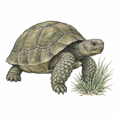
The Mojave population is federally listed and occurs north and west of the Colorado River. USFWS species overview
Start with the geography
The range spans southeastern California, southern Nevada, southwestern Utah, and northwestern Arizona. Use the map to orient your project, then review the site and the applicable agency guidance.
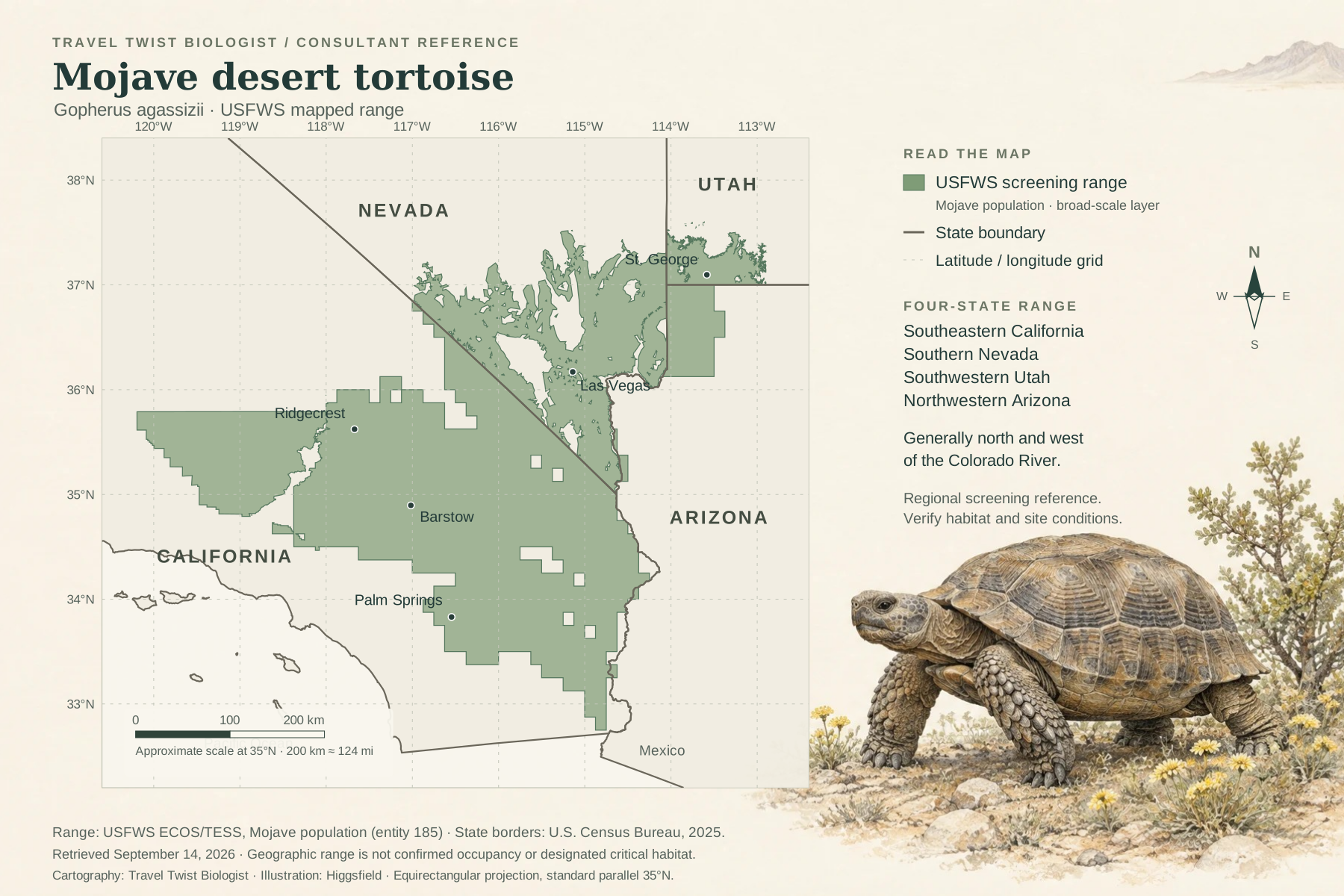
Range geometry: USFWS Mojave population range layer, retrieved September 14, 2026. State borders: U.S. Census Bureau, 2025. Original cartography by Travel Twist Biologist with Higgsfield illustration. For a habitat-potential view, see the USGS model reproduced in the 2019 USFWS protocol, Figure 1.
Start with the work area, access routes, proposed activities, and schedule. Review existing surveys and project approvals, then confirm the appropriate survey approach with the responsible agency office. A location-based species list in USFWS IPaC can support that review.
Need to share the work area? Draw a project outline or map it with your phone.
Official documents
Pre-project surveys, clearance work, and monitoring serve different purposes. Check the document date and the project’s written conditions before planning fieldwork.
USFWS guidance for determining presence, estimating abundance when appropriate, and documenting habitat. Includes survey types, field methods, and reporting information.
USFWS · October 8, 2019
Open survey protocol
Reference chapters on clearance surveys, handling, exclusion fencing, and biologist roles. Use this older manual with current agency guidance and project-specific conditions.
USFWS · December 2009 · PDF
Open field manual
Find USFWS state contacts, surveyor resources, and training information. This is a useful starting point for confirming the current instructions for your work area.
USFWS · Live resource collection
Find guidance and contactsA document or training certificate does not itself authorize handling, relocation, or other restricted work. The relevant authorizations and their conditions control the activities allowed.
For consulting biologists
The USFWS Desert Tortoise Authorized Biologist Qualifications Form provides a structure for documenting education, training, relevant experience, and the project duties for which authorization is sought.
The verified source is Section 3.2 of the December 2009 field manual, starting on printed page 3-3 (PDF page 20). Confirm the current form and submission instructions with the responsible agency office.
About the species
Burrows help tortoises avoid harsh conditions. Time spent below ground makes survey timing and careful observation important.
Habitat includes alluvial fans, washes, canyons, and rocky foothills. Site conditions matter alongside the broad range map.
Desert tortoises can live roughly 50–80 years and take about 13–20 years to reach sexual maturity. Habitat loss, roads, disease, and other pressures affect their recovery.
Biology and threats: USFWS species account. This page focuses on the Mojave population, not the Sonoran desert tortoise (Gopherus morafkai).
California & Nevada
Elizabeth provides Mojave desert tortoise field support, construction monitoring, and reporting within the project’s required authorizations.
Handling or relocation is not implied. Duties, supervision, and required approvals are confirmed when the work is scoped.
Include the project area, proposed activities, target dates, existing surveys, and relevant permit or biological-opinion conditions.
Reference links checked September 14, 2026. Agency guidance and project conditions can change; use the linked official sources when planning work.
See all consultant tools and resources